
Lêer:Hanoi location map.svg

Size of this PNG preview of this SVG file: 512 × 512 piksels. Ander resolusies: 240 × 240 piksels | 480 × 480 piksels | 768 × 768 piksels | 1 024 × 1 024 piksels | 2 048 × 2 048 piksels.
Oorspronklike lêer (SVG-lêer, normaalweg 512 × 512 piksels, lêergrootte: 226 KG)
Opsomming
| Beskrywing |
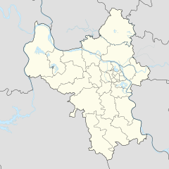
English: Location map of Hanoi |
| Datum | |
| Bron | Eie werk |
| Outeur | Mai Ngọc Xuân |
| SVG genesis | This locator map was created with Adobe Illustrator. |
Lisensiëring
Ek, die outeursreghouer van hierdie werk, publiseer dit onder die volgende lisensie:
This file is licensed under the Creative Commons Attribution-Share Alike 4.0 International license.
- U is vry:
- om te deel – die werk kopieer, versprei en deurgee
- om te hermeng – om die werk aan te pas
- Onder die volgende voorwaardes:
- naamsvermelding – U moet die nodige krediet gee, 'n skakel na die lisensie verskaf en aandui of daar veranderinge aangebring is. U mag dit op enige redelike manier doen, maar nie op enige manier wat daarop dui dat die lisensiegewer u of u gebruik onderskryf nie.
- insgelyks – As u die materiaal hermix, transformeer of voortbou, moet u u bydraes versprei onder die dieselfde of versoenbare lisensie as die oorspronklike.
Lêergeskiedenis
Klik op die datum/tyd om te sien hoe die lêer destyds gelyk het.
| Datum/Tyd | Duimnael | Dimensies | Gebruiker | Opmerking | |
|---|---|---|---|---|---|
| huidig | 20:35, 1 Desember 2022 | | 512 × 512 (226 KG) | Hakutora | add water layer |
| 04:38, 14 Augustus 2021 |  | 512 × 512 (43 KG) | Hari caaru | Adjust boundaries | |
| 13:45, 14 Oktober 2017 |  | 512 × 512 (43 KG) | Hakutora | update | |
| 15:54, 5 Oktober 2017 |  | 512 × 511 (139 KG) | Hakutora | User created page with UploadWizard |
Lêergebruik
Daar is geen bladsye wat dié lêer gebruik nie.
Globale lêergebruik
Die volgende ander wiki's gebruik hierdie lêer:
- Gebruik in en.wikipedia.org
- Noi Bai International Airport
- Gia Lâm district
- Đông Anh district
- Thanh Trì district
- Ba Vì district
- Chương Mỹ district
- Đan Phượng district
- Hoài Đức district
- Mỹ Đức district
- Phú Xuyên district
- Phúc Thọ district
- Quốc Oai district
- Thạch Thất district
- Thanh Oai district
- Thường Tín district
- Ứng Hòa district
- Mê Linh district
- Lĩnh Nam
- Module:Location map/data/Vietnam Hanoi
- Module:Location map/data/Vietnam Hanoi/doc
- Linh Đàm
- Khương Đình
- Gebruik in fr.wikipedia.org
- Gebruik in ia.wikipedia.org
- Gebruik in id.wikipedia.org
- Gebruik in ja.wikipedia.org
- Gebruik in ms.wikipedia.org
- Gebruik in ru.wikipedia.org
- Gebruik in si.wikipedia.org
Wys meer globale gebruik van die lêer.