
Lêer:Philippines relief location map (Mindanao).svg

Size of this PNG preview of this SVG file: 656 × 486 piksels. Ander resolusies: 320 × 237 piksels | 640 × 474 piksels | 1 024 × 759 piksels | 1 280 × 948 piksels | 2 560 × 1 897 piksels.
Oorspronklike lêer (SVG-lêer, normaalweg 656 × 486 piksels, lêergrootte: 2,21 MG)
.svg)
Opsomming
| Beskrywing |
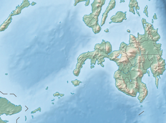
English: Physical location map of the Philippines (Mindanao)
Equirectangular projection based on the parallel of 10°43' N
|
| Datum | |
| Bron | File:Philippines location map (square).svg |
| Outeur | User:Hellerick |
| Ander weergawes |
This file was derived from: Philippines relief location map (square).svg: .svg) |
.svg)
Lisensiëring
Hierdie lêer is gelisensieer onder die Creative Commons Erkenning-Insgelyks Deel 3.0 Onoorgedraagde lisensie.
- U is vry:
- om te deel – die werk kopieer, versprei en deurgee
- om te hermeng – om die werk aan te pas
- Onder die volgende voorwaardes:
- naamsvermelding – U moet die nodige krediet gee, 'n skakel na die lisensie verskaf en aandui of daar veranderinge aangebring is. U mag dit op enige redelike manier doen, maar nie op enige manier wat daarop dui dat die lisensiegewer u of u gebruik onderskryf nie.
- insgelyks – As u die materiaal hermix, transformeer of voortbou, moet u u bydraes versprei onder die dieselfde of versoenbare lisensie as die oorspronklike.
Lêergeskiedenis
Klik op die datum/tyd om te sien hoe die lêer destyds gelyk het.
| Datum/Tyd | Duimnael | Dimensies | Gebruiker | Opmerking | |
|---|---|---|---|---|---|
| huidig | 14:36, 27 Oktober 2017 | | 656 × 486 (2,21 MG) | Mliu92 | Updated crop to add missing island. |
| 17:23, 26 Oktober 2017 |  | 573 × 573 (2,21 MG) | Mliu92 | User created page with UploadWizard |
Lêergebruik
Daar is geen bladsye wat dié lêer gebruik nie.
Globale lêergebruik
Die volgende ander wiki's gebruik hierdie lêer:
- Gebruik in bcl.wikipedia.org
- Gebruik in bn.wikipedia.org
- Gebruik in en.wikipedia.org
- Sulu Sea
- Moro Gulf
- Mount Apo
- Davao Gulf
- Iligan Bay
- Panguil Bay
- Bud Dajo
- Mount Butung
- Agusan River
- Lake Lanao
- Rio Grande de Mindanao
- Butuan Bay
- Mount Agad-Agad
- Mount Hibok-Hibok
- Mount Makaturing
- Mount Matutum
- Musuan Peak
- Agus River
- Sibuguey Bay
- Illana Bay
- Mount Sumagaya
- Dinagat Island
- Davao River
- Leonard Kniaseff
- Mount Kitanglad
- Macajalar Bay
- Pulangi River
- Cagayan River (Mindanao)
- Mount Dulang-dulang
- Tagoloan River
- Lake Buluan
- Lake Wood (Philippines)
- Lake Dapao
- Mount Malindang
- Mount Kalatungan
- Latukan
- Mount Balatukan
- Mount Hamiguitan
- Mount Baya
- Agusan Marsh Wildlife Sanctuary
- Camp General Basilio Navarro
- 2010 Mindanao earthquakes
- Manupali River
Wys meer globale gebruik van die lêer.
.svg)
.svg)